


Seoul
Places to visit in Yongsan-gu
The scenery changes from hillside neighborhoods on the slopes of Namsan to the Hangang River waterfront. Consider Itaewon's alleys, the museums, and Nodeul Island as separate destinations for an outing.
Explore on the map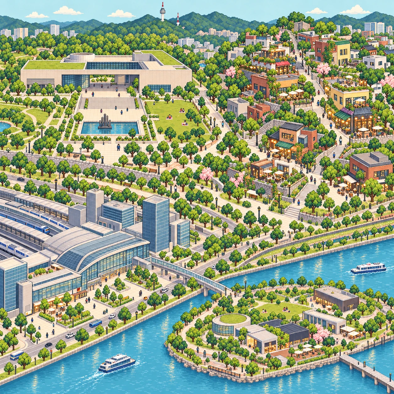
Places to visit
49 placesLive crowd levels and weather for major places in Seoul are on the map.
Itaewon Special Tourist Zone
Restaurants and shops from many countries line these streets. Take your time exploring the different scenes along the main roads and up the hillside alleys.
View on mapSamgakji Station
This station area lies where Hangang-daero and Itaewon-ro meet. Start an outing to nearby Yongridan-gil or the War Memorial of Korea.
View on mapYongsan Station
This is a Yongsan transport hub with a railway station and large shopping facilities. Walk around the plaza in front of the station and nearby alleys to continue exploring the city.
View on mapItaewon Station
This subway station brings you to Itaewon's central streets. Explore international restaurants and shops, as well as alleys leading up the hills.
View on mapYongridan-gil
This is a restaurant and cafe district between Sinyongsan and Samgakji stations. Its streets blend low old buildings with newer shops.
View on mapItaewon Antique Furniture Street
Shops selling vintage furniture and accessories line this street. Browse the small stores and take a closer look at the shapes and materials of the items on display.
View on mapHaebangchon and Gyeongnidan-gil
Shops and homes follow the hillsides at the foot of Namsan Mountain. Climb the sloping alleys for views of the city and the neighborhood.
View on mapNational Museum of Korea and Yongsan Family Park
This area includes a museum displaying Korean history and art, and an adjacent park. After visiting the exhibitions, spend some time outdoors by the pond and along the walking paths.
View on mapNodeul Island
This cultural space sits on an island in the middle of Hangang Bridge. Walk along the river and enjoy the Han River views around the lawn and performance spaces.
View on mapIchon Hangang Park
This riverside park stretches along the northern bank of the Han River in Ichon-dong. Walk by the water or along the exercise areas, or take a break with a view of the river.
View on mapSeobinggo-dong Bugundang Shrine
Bugundang shrines are a traditional form of village worship in Seoul, where people pray to guardian deities for the village's peace and good fortune. Images of Joseon founder Yi Seong-gye and his wife, the main deities, are enshrined at the front, with the Three Buddhas of Jeseok on the left wall.
View on mapDongbinggo Bugundang Shrine
For hundreds of years, residents have worshipped Dangun and his wife, along with other deities, here and prayed for the safety of the community and peace throughout the country.
View on mapFormer US Officers' Quarters at Yongsan Garrison (now Yongsan Park)
This is part of the Yongsan Garrison, where US military officers' quarters once stood. Walk through the open area and its buildings to learn about the site's past and how it has changed.
View on mapKim Yu-sin Shrine
Originally a Bugundang shrine for village deities, it enshrined General Kim Yu-sin as its main deity and was called Myeonghwajeon.
View on mapBogwang-dong Muhumyo Shrine
This Seoul village shrine houses shaman paintings of Zhuge Liang, his wife, the mountain spirit, and the Blue and Red Generals.
View on mapJageun Hangang Bugundang Shrine (Hannam No. 2 Bugundang)
Bugundang shrines are a traditional form of village worship in Seoul, where people pray to guardian deities for the village's peace and good fortune. The main deity here is Yi Seong-gye. Inside are images of Yi Seong-gye and his wife, as well as images of General Yong, Grandfather Mountain Spirit, and Grandmother Uldang on the side walls.
View on mapHangang Ferry Landing
The ferry post's head and the military commander at Hangangjin managed Hangangdan and the state pavilion Jecheonjeong. They also monitored a water gauge stone installed on the Hangang riverside below the pavilion.
View on mapKeun Hangang Bugundang Shrine (Hannam No. 1 Bugundang)
Bugundang shrines are a traditional form of village worship in Seoul, where people pray to guardian deities for the village's peace and good fortune. Keun Hangang Bugundang is thought to have been built in the late Joseon period.
View on mapSeoul Central Mosque
This is a place of Islamic worship in Itaewon, Seoul. Respect worshippers and visitor etiquette as you explore the building and nearby streets.
View on mapYu Gwan-sun Memorial Stone
After enduring severe torture, independence activist Yu Gwan-sun died at Seodaemun Prison on September 28, 1920, and was buried in Itaewon Cemetery, then located around present-day Itaewon and Bogwang-dong. To honor her, a memorial stone was erected beside Itaewon Bugundang Shrine, and the area was developed as Itaewon Bugundang Historic Park.
View on mapItaewon Bugundang Shrine
This traditional place of worship was where residents prayed for the village's well-being. The shrine and nearby historic park offer a glimpse into Itaewon's past.
View on mapChanbaramjae Pass
The area was once called Chanbaramjae or Hanpungjae because of the fierce cold winds that blew here in winter. Today it is known as Noksapyeong, meaning a field lush with green grass.
View on mapSeoul Marine Corps Headquarters First Church
The church began as the Marine Corps' first church in 1951. It is the oldest church still standing within Korea's military.
View on mapWar Memorial of Korea
Built in Yongsan in 1994, the War Memorial of Korea collects and preserves materials on wars, including the defense against foreign invasions and the struggle to protect national independence. It aims to help prevent war and contribute to the peaceful reunification of the country by teaching the lessons of war.
View on mapGyeongseong Hoguk Shrine Stairway (108 Steps)
This was the entrance path used to climb to Gyeongseong Hoguk Shrine during Japanese colonial rule. Korean property and labor were used to complete it, and the site starkly reflects the tragedy of colonial Korea in the final years of Japanese rule.
View on mapHuam-dong Joseon Bank Housing Site
This was a notable planned housing area that developed as Huam-dong underwent significant growth alongside Seoul's urbanization in the 1920s, during Japanese colonial rule.
View on mapFormer Yongsan Public Market (now Namyeong Arcade)
The market was established by the Japanese colonial government in 1922 and is now called Namyeong Arcade.
View on mapSeoul City Wall
The wall was built to mark the boundaries of Hanseong, the Joseon capital, display its authority, and protect it from outside invasions.
View on mapNamsan Mountain and N Seoul Tower
This destination includes the observation tower at the summit of Namsan and the surrounding walking areas. Take in views of central Seoul and the night scenery from the forest paths and observation deck.
View on mapFormer Namyeong-dong Anti-Communist Investigation Office (now Democracy Movement Memorial)
This building once housed the Namyeong-dong Anti-Communist Investigation Office. Its preserved spaces and records tell the history of democracy and human rights.
View on mapFormer Pungkuk Confectionery Factory (now Orion)
Pungkuk Confectionery was a company with its headquarters and factory in Yongsan during Japanese colonial rule, and was established at this site in 1934. After liberation, the company came under government ownership. In 1956, Lee Yang-gu acquired it and founded Dongyang Confectionery Industrial Co., Ltd.
View on mapDanggogae Martyrs' Shrine
This area also served as an execution ground in the late Joseon period. Around ten Catholics were martyred here during the 1839 Gihae Persecution. Today, the shrine commemorates those martyrs.
View on mapFormer Kanzo Gyeongseong Branch Building
Kanzo was a major construction and civil engineering company during Japanese colonial rule. It entered Korea in 1903 to work on the Gyeongbu Railway and built infrastructure, including roads, railways, and military facilities, to support Japan's colonial rule. The building is now used as an office by a food ingredients company.
View on mapWaeogae Martyrs' Shrine
The name Waeogae is said to come from Waseo, an office in the Joseon period. The area became known as a Catholic martyrdom site after clergy and believers executed during four late Joseon persecutions, the Sinyu, Gihae, Byeongo, and Byeongin Persecutions, were buried here.
View on mapYeonboksa Pagoda Reconstruction Stele
A stele recording the history of the five-story Buddhist pagoda at Yeonboksa, rebuilt through the efforts of Yi Seong-gye, founder of Joseon.
View on mapLee Bong-chang History Hall
Built to commemorate Lee Bong-chang, a leading independence fighter from Yongsan-gu, and honor his life and spirit of independence.
View on mapLee Bong-chang's Former Home Site
Lee Bong-chang lived here from 1917, when he was 11, until 1925, when he was 25. On January 8, 1932, he attempted to assassinate Japanese Emperor Hirohito.
View on mapNam I General Shrine
According to oral tradition, troops were trained in Dunji-mi, near present-day Samgakji, during the campaign against Yi Si-ae's Rebellion, and General Nam I was executed by the Han River at Saenamteo. A shrine was built for him in Yongsan, where communal rites and shamanic ceremonies were held for 300 years to soothe his spirit.
View on mapBaekbeom Kim Koo Memorial Hall
The memorial hall opened on October 22, 2002, to share Kim Koo's life and ideas and carry on his legacy.
View on mapYongsan Printing Workers' March 1st Movement Site
The site of a protest in Yongsan during the March 1st Movement in 1919, where the Yongsan Printing Office once stood.
View on mapSancheondong Bugundang Shrine
A Bugundang is a shrine to a local deity believed to protect a village's peace and bring good fortune, and is part of Seoul's village folk religion. Rites at Sancheondong Bugundang were held in spring and autumn, but today take place once a year in autumn.
View on mapYongsan Seminary
Built in 1892, the seminary was designed and supervised by French priest Coste. It was the first seminary building in Korea.
View on mapSeoul Wonhyoro Sacred Heart Church
Built in 1902 and designed and supervised by French priest Coste, the church is a notable example of late 19th-century church architecture.
View on mapSimwonjeong Stele Marking the Ming-Japanese Peace Talks
This is said to be where Ming general Sim Yu-gyeong and Japanese general Konishi Yukinaga met for peace talks during the Imjin War.
View on mapFormer Yongsan Water Level Observatory
This facility was used to monitor the Han River's water level and flood levels. The riverside building offers a glimpse into how these observations were made in the past.
View on mapCheongam-dong Bugundang Shrine
A Bugundang is a shrine to a local deity believed to protect a village's peace and bring good fortune, and is part of Seoul's village folk religion. In Cheongam-dong, a Bugundang housing shaman paintings of 12 deities once stood beside a shrine dedicated to Yi Seong-gye.
View on mapSaenamteo Execution Site
A broad sandbar formed by flooding of the Han River, Saenamteo was used as a military training ground and a place to execute serious offenders.
View on mapSaenamteo Martyrs' Shrine
The site became known as a Catholic martyrdom site after believers were executed here during four persecutions in the late Joseon period. The Korean Catholic Church designated the site in 1950. Saenamteo Church was founded in 1981, and its church building and memorial hall were completed in 1987.
View on mapFormer Main Building of Yongsan Railroad Hospital (now Yongsan History Museum)
Yongsan History Museum is housed in the former railroad hospital building. Its modern architecture and exhibits trace how Yongsan changed alongside the railway.
View on map
Scenes of the area
- Through hillside lanes to the Han River.
- Seobinggo-dong Bugundang Shrine and Dongbinggo Bugundang Shrine.
- Jageun Hangang Bugundang Shrine, also known as Hannam Second Bugundang Shrine, and a Hangang ferry landing.
- Itaewon Bugundang Shrine and Chanbaramjae Pass.
- The former Chosun Bank staff housing site in Huam-dong and the former Yongsan Public Market, now Namyeong Arcade.
- The former Pungkuk Confectionery factory, now Orion, and Danggogae Martyrs' Shrine.
- Lee Bong Chang Historical Hall and the site of Lee Bong Chang's former home.
- Sancheon-dong Bugundang Shrine and Yongsan Theological Seminary.
- Cheongam-dong Bugundang Shrine and Saenamteo Martyrs' Shrine.